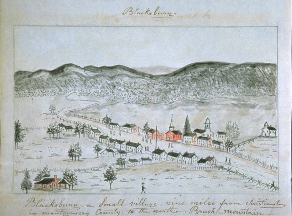
Blacksburg Maps
Sanborn Maps of Blacksburg
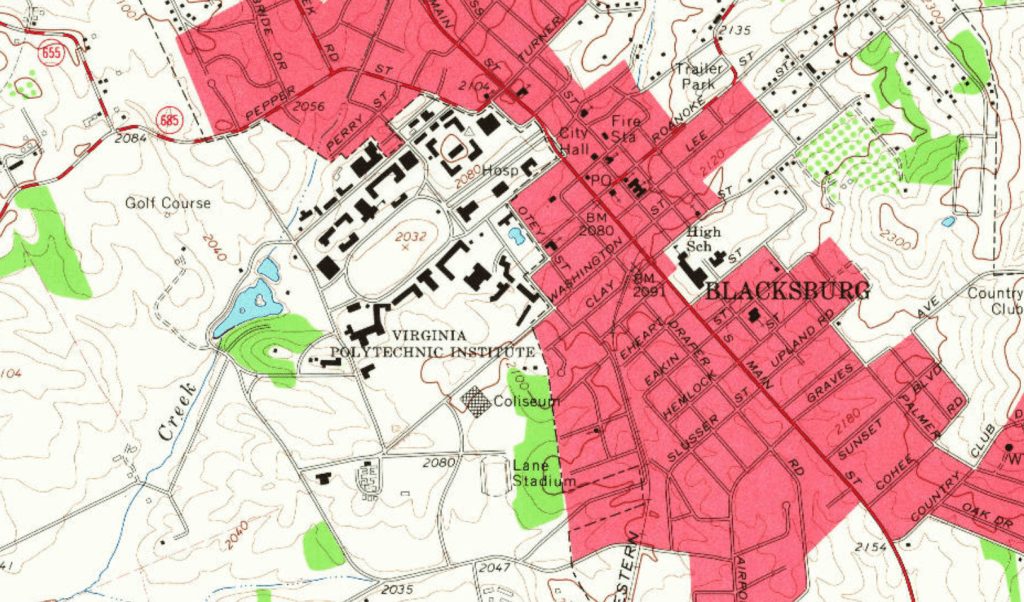
Blacksburg Town Maps
- Town Modern Map
- Town Historic District Document and Map with PDF Key
- The National Register of Historic Places Document for Blacksburg’s Historic District, 1990
- A Survey of Historic Architecture in the Blacksburg Historic District, Montgomery County, Virginia, by Gibson Worsham, 1997

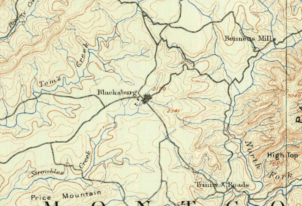
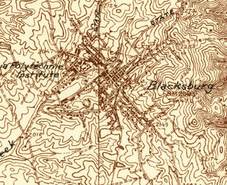
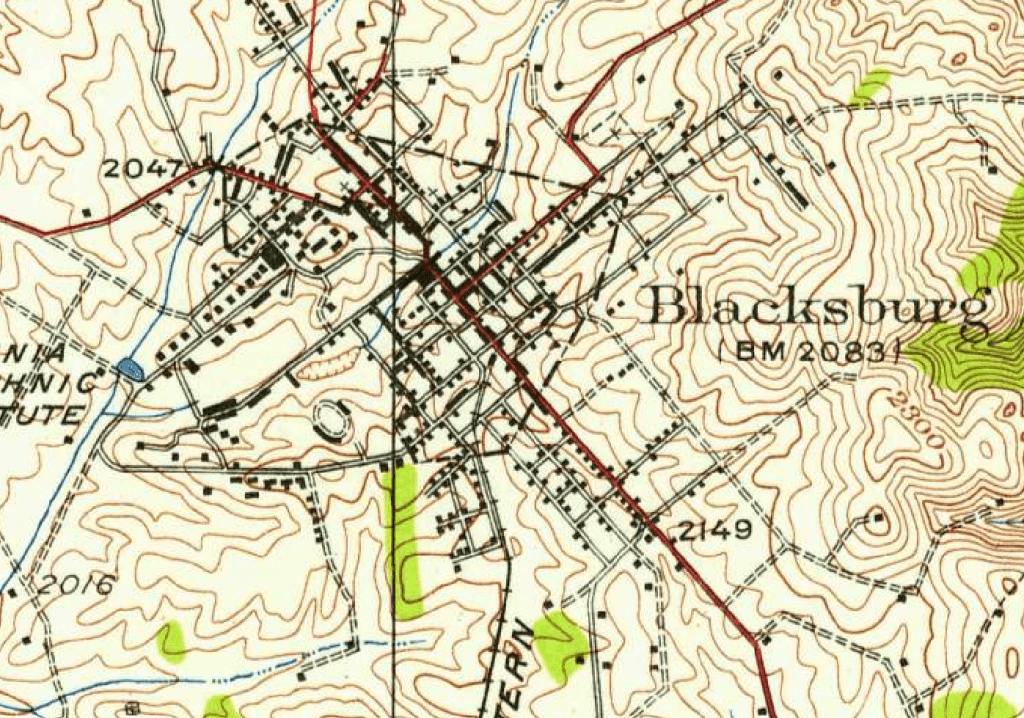
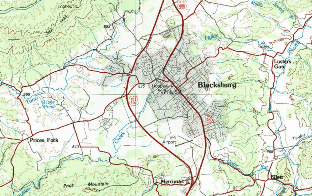
Blacksburg USGS Maps
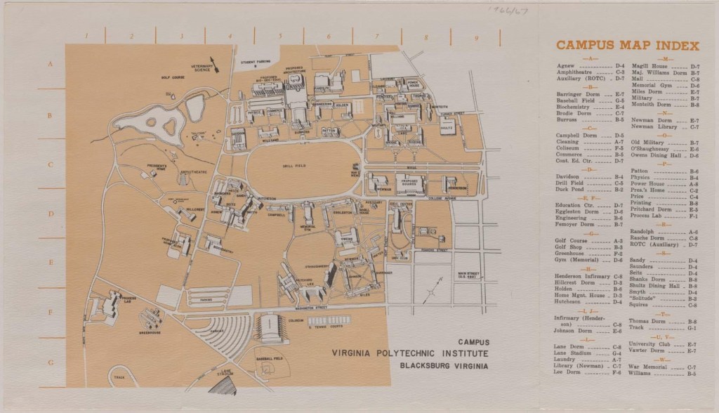
Virginia Tech Maps & Roads
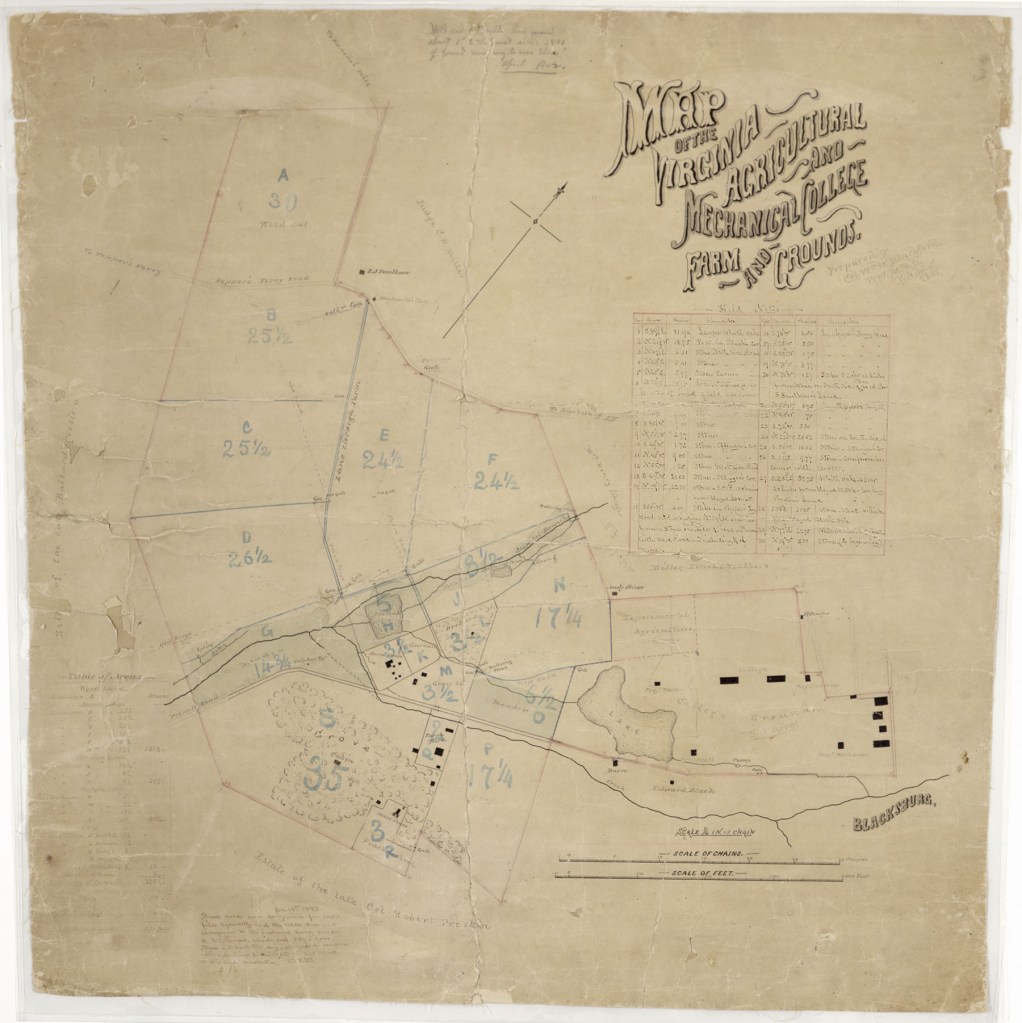
1881 Virginia Agriculture & Mechanical College Map
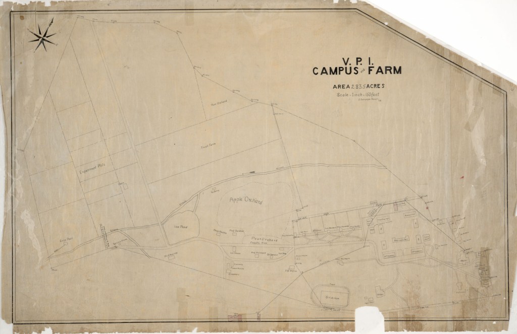
1908 VPI College Map
Source: Jenkins MIkell Robertson (compiler and editor), Historical Data Book: Centennial Edition (Blacksburg, Va, 1972), Bulletin vol. 65, no. 4, April 1972.
“The map shows the location of buildings on the Virginia Tech campus in February 1908. The shaded buildings, identified with circled numbers, still stand in some form on the campus. The solid black buildings, identified with capital letters, are gone. The area marked “Drill Field” was not called by that name until 1926.”
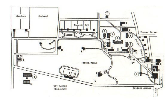
Buildings Still Standing
1—Barracks No. 1 (Completed 1888; now known as Lane Hall)
2—Barracks No. 2 (Completed 1894; now known as old section of Rasche Dormitory)
3—Barracks No. 3 (Completed 1900; now known as old section of Brodie Dormitory)
4—Barracks No. 4 (Completed 1902; now known as old section of Shanks Dormitory)
5—Barracks No. 5 (Completed 1904; now known as old section of Major Williams Dormitory)
6—YMCA (Completed 1899; later known as Military Building; Student Personnel Building; Performing Arts Building)
7—Laundry (Completed 1903; now known as Building 201, housing the University’s Security Division)
8—Infirmary (One section completed 1876 for use as the President’s Home; converted to infirmary with completion of a second wing in 1902; both early wings are now known as the old section of Henderson Hall)
9—Agricultural Hall (Completed 1907; now known as Price)
Buildings No Longer Standing
A—Preston and Olin Building (The firs and only building on campus until 1896; burned down in 1913.)
B—Foundry/Forge Shop (Built 1982; razed 1917)
C—Steam Laundry (Wooden building; used earlier as machine shop)
D—Pavilion (Used at various times as drill hall, assembly hall, mess hall, gymnasium, dance hall; torn down in 1940)
E—Mess Hall (Known at times as Commencement Hall, German Hall, and Commerce Hall; razed in 1957)
F—Commandant’s House (Originally built for Prof. John E. Christian; torn down in 1962)
G—Powder Magazine (Used to store ammunition for cadet training)
H—Chapel (Used at various times as auditorium, dance hall, gymnasium, and finally as the College Library. After the building burned in 1953 the present library was built on the site)
I—Gibboney Field (Track , baseball, and football; originally called Sheib Field; name changed to Miles Field in 1909)
J—Bleachers (Torn when Miles Stadium opened in 1926)
K—Greenhouses
L—Creamery
M—Horticulture Hall (Built in 1890 for Agriculture Experiment Station; also used at various times by the Agricultural Extension Division, several academic departments, and by women students was torn down in 1936 to make way for approaches to Burruss Hall)
N—Administration Building (Used earlier as a residence for Prof. William B. Alwood; destroyed by fire in 1900; rebuilt in 1904 as an administration building)
O—Second Academic Building (Razed in 1957 to make way for the new section of Brodie Dormitory; contained College Library from 1877-1914)
P—First Academic Building (First major building built by the new College; used at various times for administrative offices and the mess hall in addition to academic departments; razed in 1957 to make way for new section of Rasche)
Q—Science Hall (Mostly destroyed by fire in 1905; rebuilt that year; remodeled as Barracks No. 7 in 1927; razed in 1957 to make way for new section of Shanks Dormitory)
R—Power House (Completed during 1900 for use as heating and electric power plant; Thomas Dormitory now occupies the site)
S—Marks the site of the wooden Field House (Built in 1914; burned down in 1923)
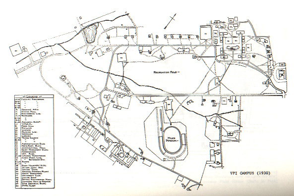
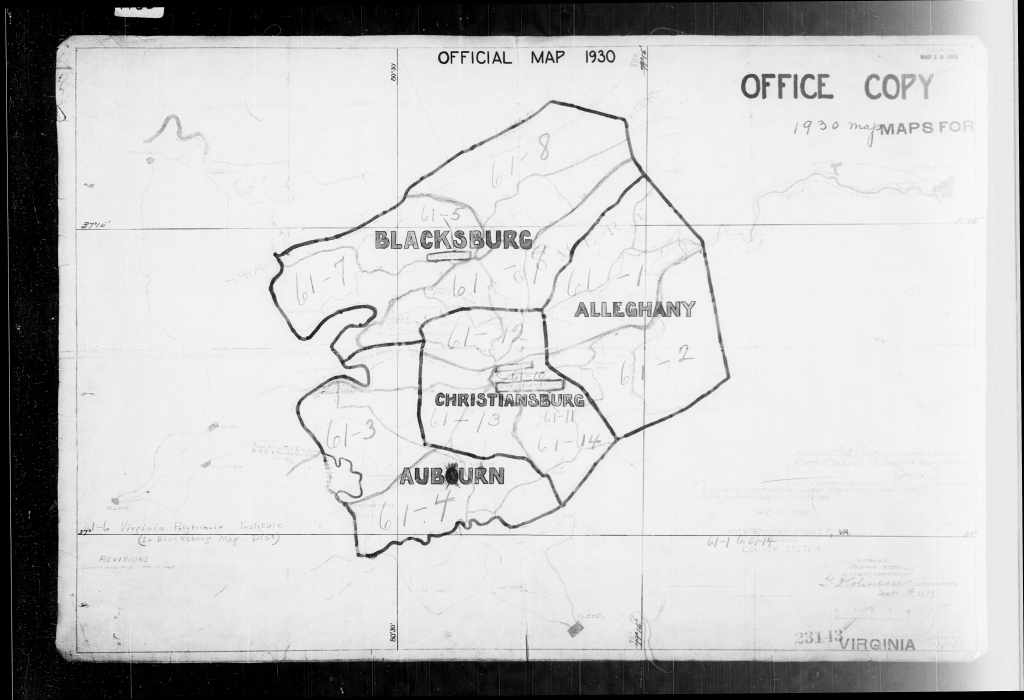
1930 Campus Map
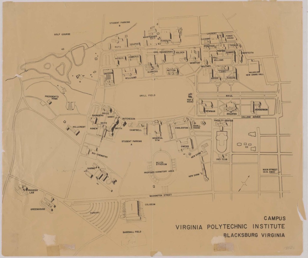
1946 Campus Map with Homes Listed, click on a house to see more information on each house.
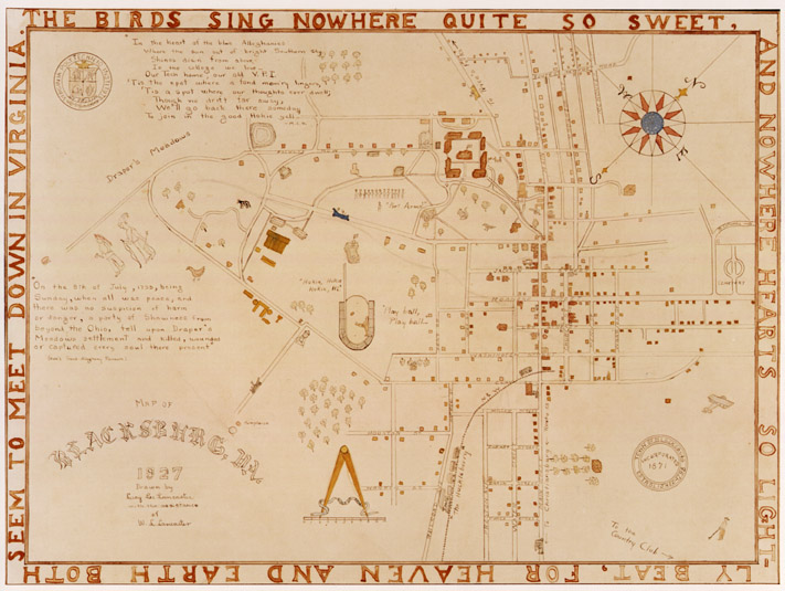
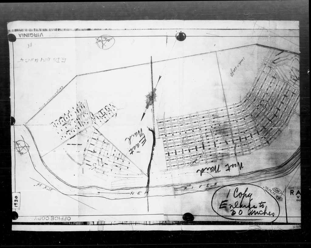
Blacksburg 1927 Map
Lucy Lee and her father, William L. Lancaster created this map of Blacksburg in 1927. Her father’s skill as a surveyor and her keen attention to detail provides us with a snapshot of this burgeoning town. Click on the image for the high resolution version.

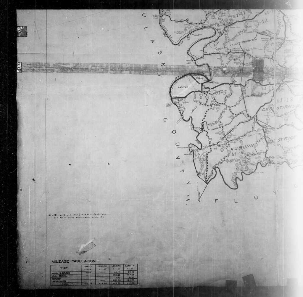
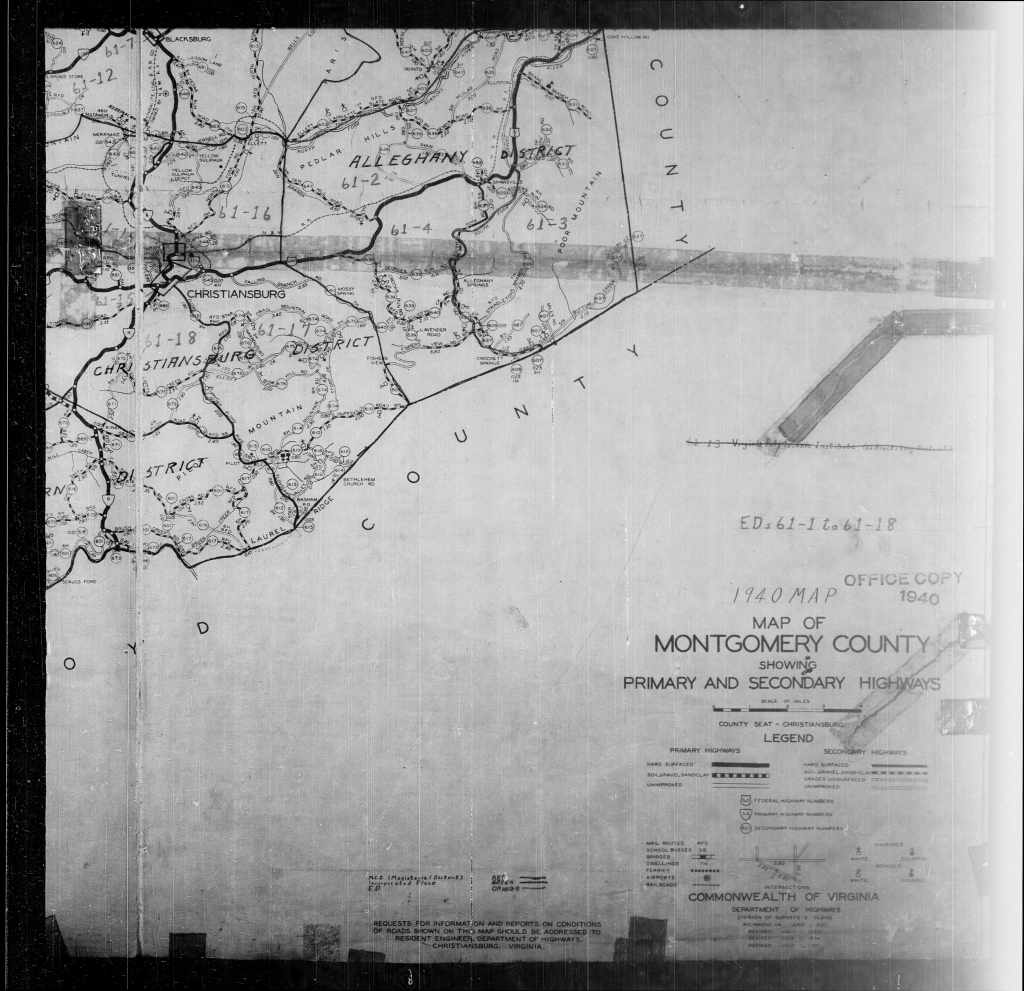
Montgomery County Maps
Montgomery Interactive Maps
- MyGIS OneView Interactive Map Excellent portal to land information as well as deed and parcel numbers.
- Real Estate Information and Property Records Search Use the MyGIS to find the parcel number, copy and then paste into this website under Parcel ID.
- Montgomery County GIS and Web Soil Survey (can be used to estimate an area)
- Historical Marker Database – Want to know what markers are in any area of the USA?
Montgomery School Maps
Montgomery County Historic Maps
- Family Search Census Maps
- Department of Interior, Geological Survey 1937 Map of most of Montgomery County with mines, churches, and schools noted. Portion of the map is missing. Arthur C. Bevan, attribution. The University of Texas version which is more complete.
- 1965 Blacksburg Topographical Map, 1983 revision
- Virginia and West Virginia Historic Maps – Michell’s Atlas Maps of 1870, 1880 and 1890
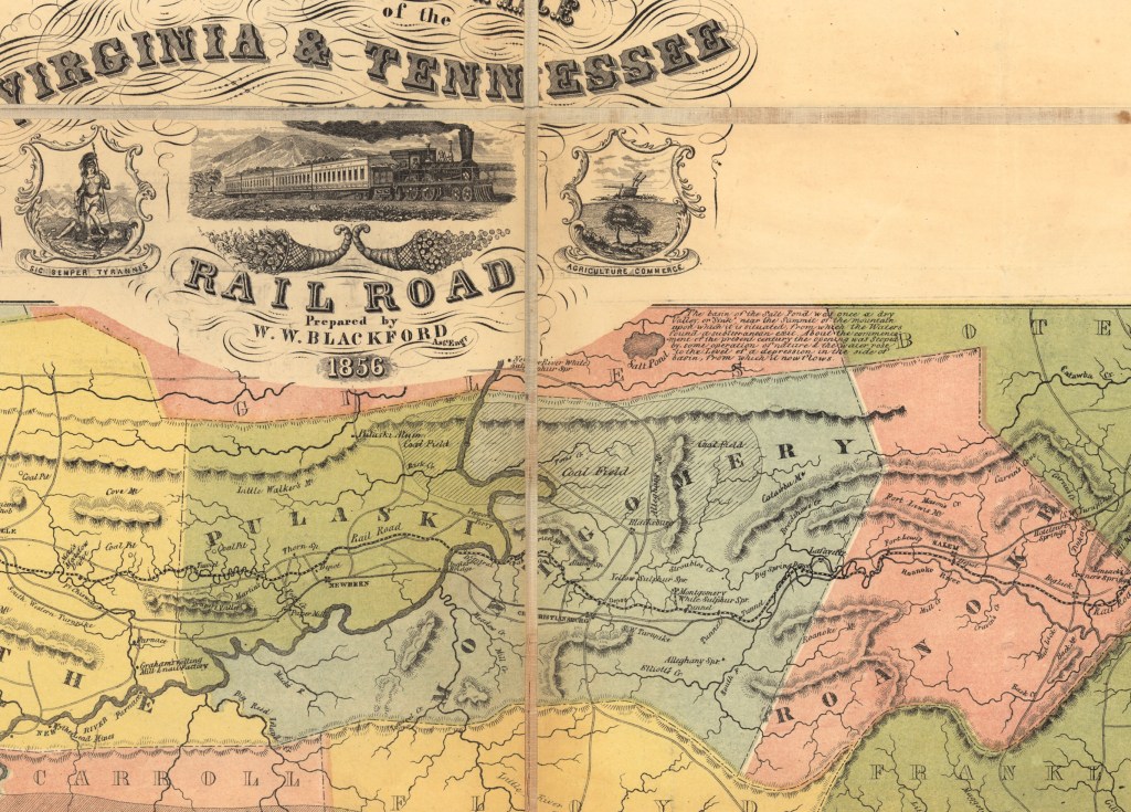
- Virginia and Tennessee Railroad Map 1856
- Montgomery and Giles County maps found in the Library of Congress
- Map of Montgomery County (Confederate Gilmer Map) and a high resolution version on Fold website. This version contains the mountains.
- Craig, Giles, Pulaski (4 parts) 1864 map
- USGS Historical Topographic Maps Website
Sources of Maps
A guide to the map collection in the Special Collections Department, Newman Library, Virginia Tech. Virginia Polytechnic Institute and State University. Print Book Available in the Blacksburg, Va. Library, 1988.
Map Geek Online source for historic Virginia Maps
Articles or Papers About Maps
Miller, Ann L.. 2003. Identification and Application of Criteria for Determining National Register Eligibility of Roads in Virginia, https://www.virginiadot.org/vtrc/main/online_reports/pdf/03-r10.pdf
A Guide to Civil War maps in the National Archives. (Not much specifically on Montgomery County)
Jeremy Francis Gilmer and the Confederate Engineers’ Map description
Virginia and West Virginia: Bibliography and Sources List of sources for maps of Virginia and West Virginia (non-interactive)
Spillman, Thomas & Miller, Montgomery County Road Orders, 1777 to 1806 https://www.virginiadot.org/vtrc/main/online_reports/pdf/08-r14.pdf. This volume marks the 26th entry in the Historic Roads of Virginia series, first initiated by the Virginia Transportation Research Council (then the Virginia Highway & Transportation Research Council) in 1973. Montgomery County Road Orders 1773-1776 is the second cooperative effort of the Virginia Transportation Research Council and the New River Historical Society (following Fincastle County Road Orders 1773-1776, which was published in 2007). This volume furthers the coverage of early western Virginia transportation records begun in the previously published Orange County Road Orders 1734-1749, Augusta County Road Orders 1745-1769, Botetourt County Road Orders 1770-1778, and Fincastle County Road Orders 1773-1776
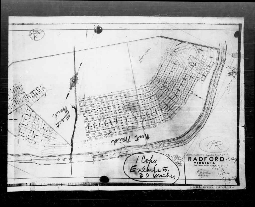
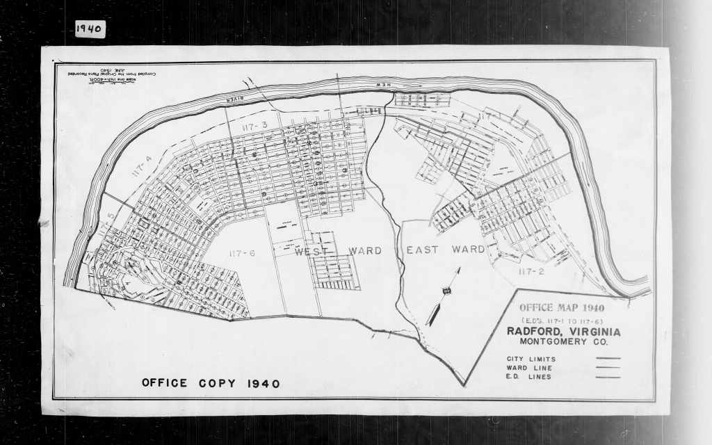
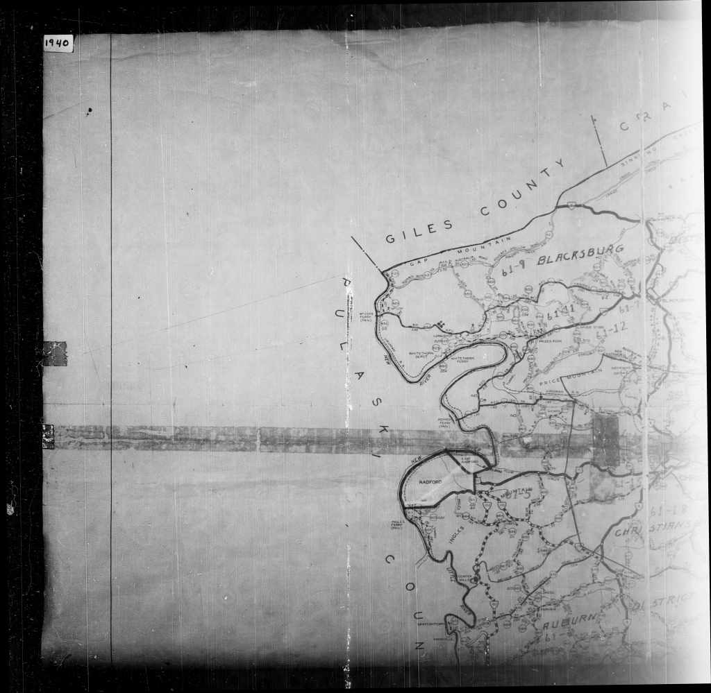
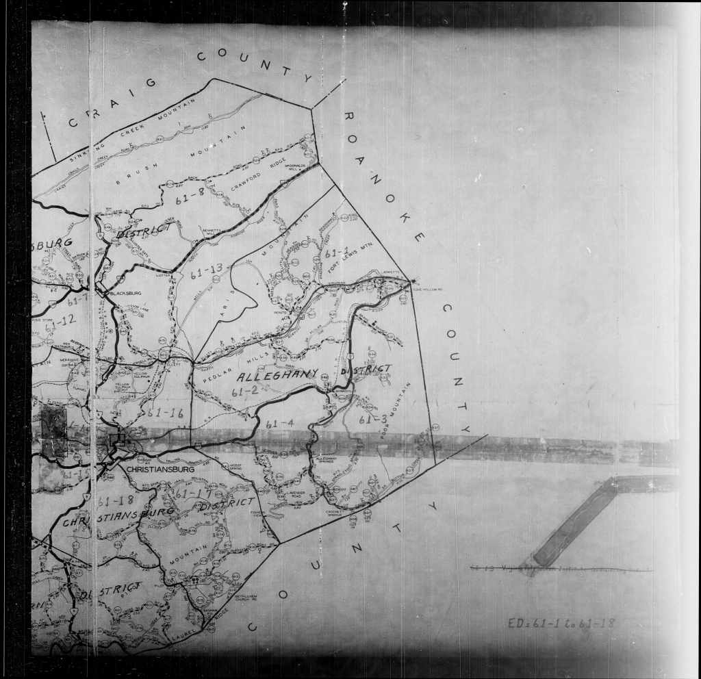
Montgomery County, Virginia Maps
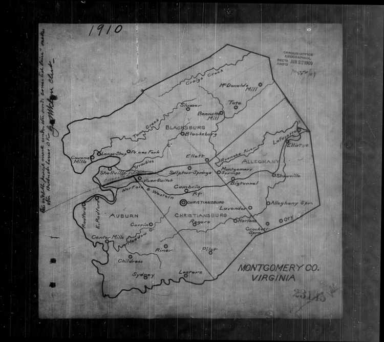
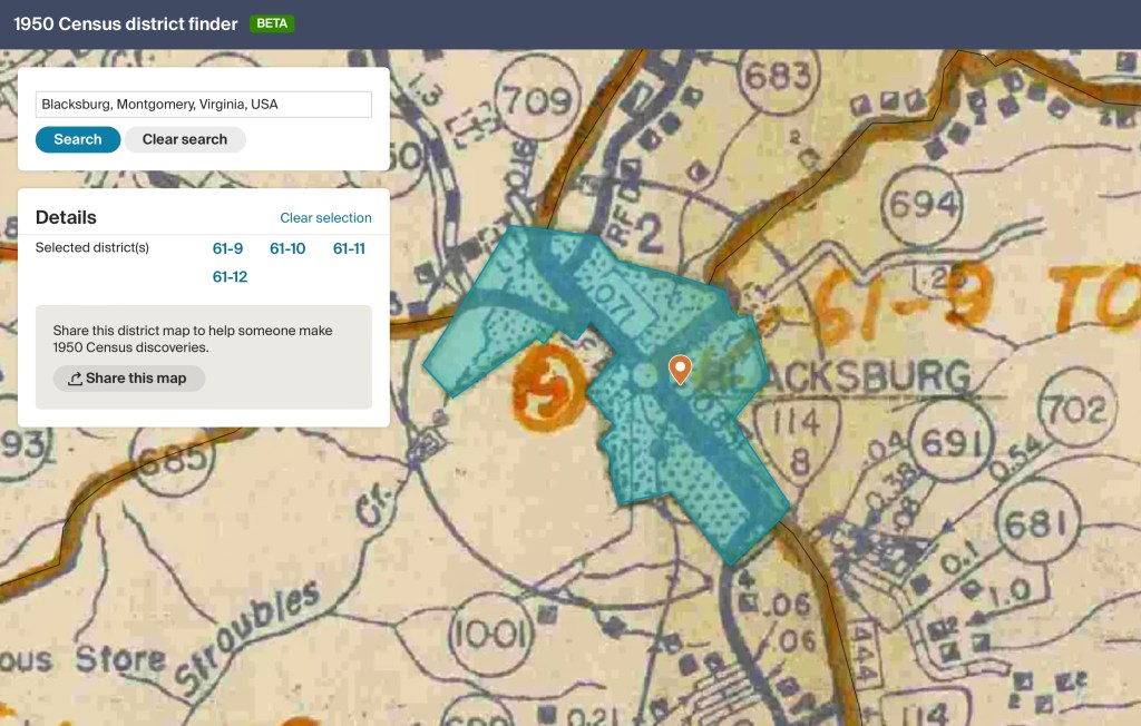
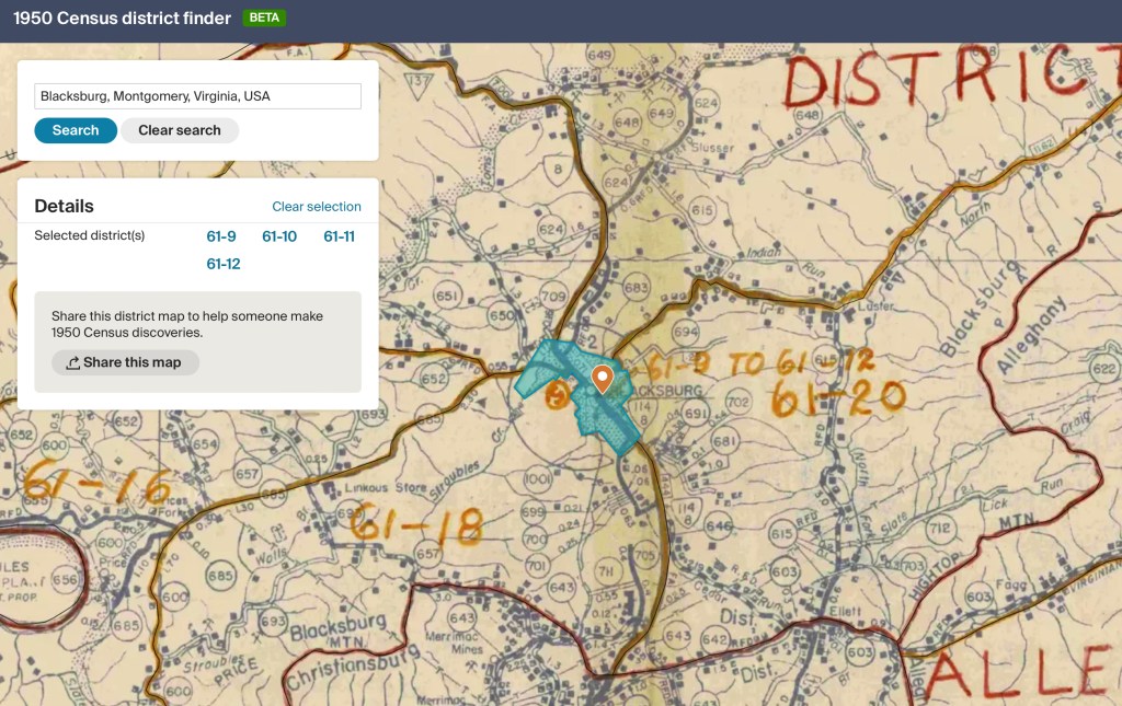
Montgomery County Census 1910 Image #128
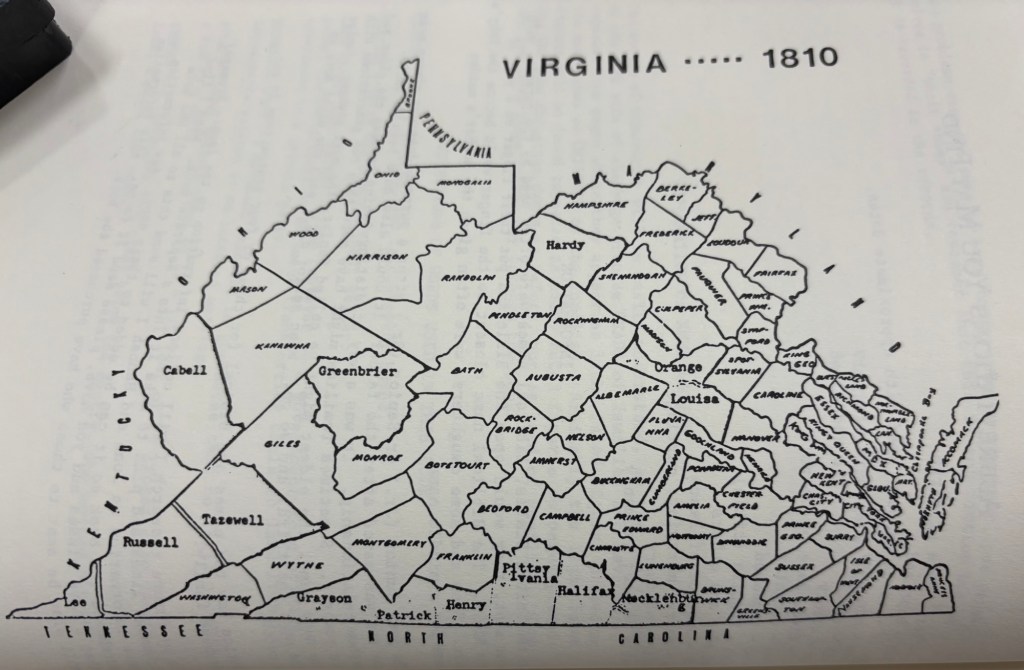
Montgomery County’s Changing Borders
When Virginia’s earliest European settlers pushed westward beyond the Blue Ridge Mountains, they entered borderlands long inhabited by Indigenous peoples. For thousands of years, Native communities had shaped, traveled, and stewarded these lands. In the 18th century, however, as waves of European colonists laid claim to the territory, Virginia’s county lines shifted repeatedly. Each new boundary reflected the pressures of settlement, population growth, and the need for local governance. Montgomery County itself was carved from these changes, its borders expanding, contracting, and redefining community identity over time. To read more…
Facebook Group Information
Facebook group, Blacksburg, Memories of the Way We Were provides a lot of information about the town, often from primary sources. As an example, VT campus maps were discussed in this post. To search on a topic search within the group.
