Montgomery County School Districts
Schools & Family Homes

Montgomery County, Virginia, 1940 School Census
The map was compiled in 1942 by Childress Hall, Surveyor and courtesy of Montgomery Museum of Art & History – high resolution version
The lists of schools are complied from this map. Unfortunately, the schools within the populated areas, Christiansburg and Blacksburg, are stylistically indicated. Also, some schools are located in one district but the students lived in another. Ellett school is a good example. Also, some students crossed into other county schools. The map is in the collection of the Montgomery Museum of Art and History. Please ask for permission for use.
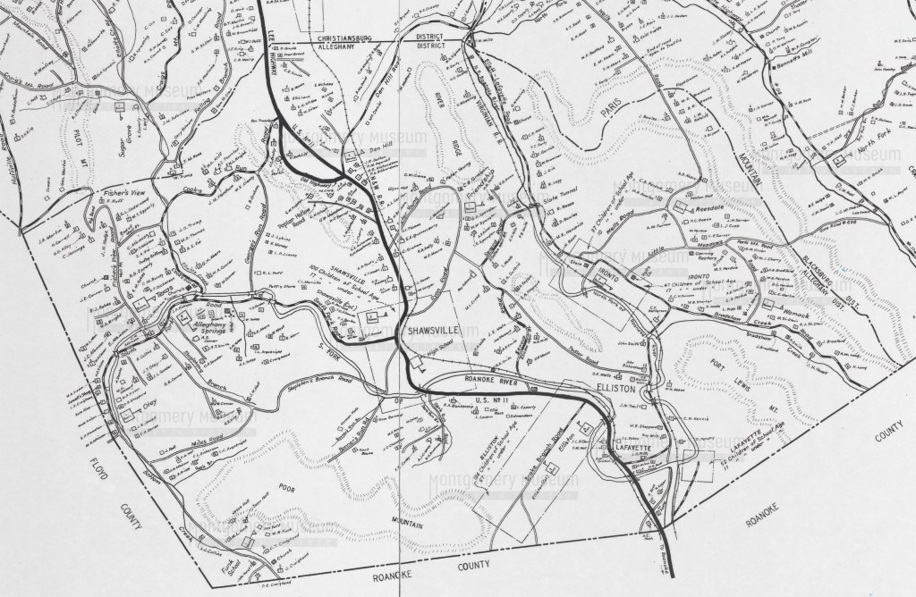
Allegheny District
- Alleghany Springs (2 rooms)
- Den Hill (2 rooms)
- Elliston Primary (2 rooms)
- Elliston Primary (4 rooms)
- Friendship (1 room)
- Funk School (1 room)
- Ironto (3 rooms)
- Lafayette
- Otey (1 room)
- Reesdale (1 room)
- Shawsville (Col.)
- Shawsville (2 rooms)
- Shawsville High School
- Texas (1 room)
- Womack (1 room)
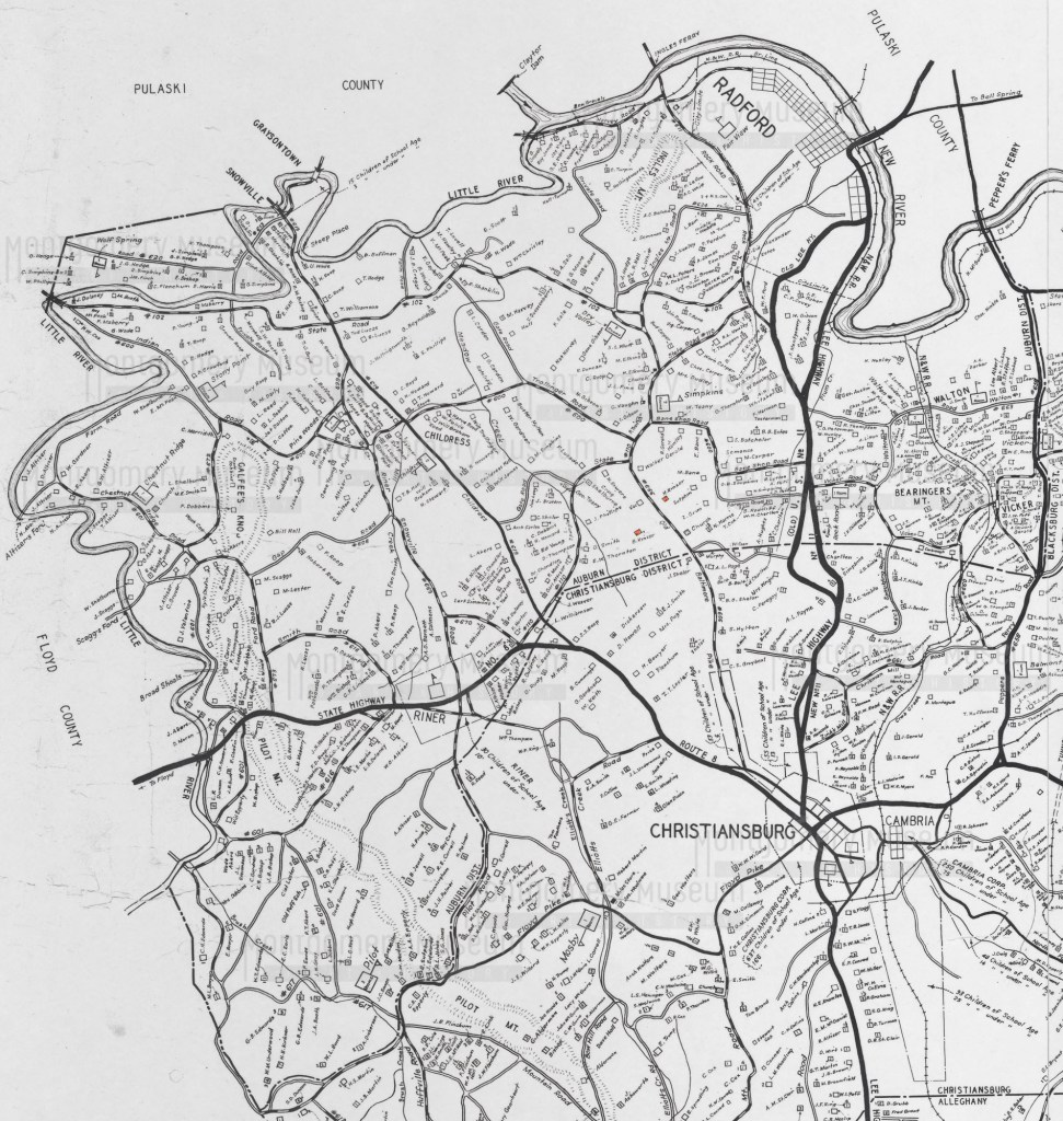
Auburn District
- Chestnut Ridge (1 room)
- Childress (2 rooms)
- Dry Valley (2 rooms)
- Fair View
- Graysontown
- Old Poff School (not active)
- Pilot (3 rooms)
- Pine Woods (1 room, Piney Wood)
- Riner
- Rock Road (1 room)
- Simpkins (2 rooms)
- Stony Point (1 room)
- Walton (1 room)
- Walton #2 (2 rooms)
- Wolf Spring (1 room)

Blacksburg District
- Blacksburg Primary, Water (Draper) St
- Blacksburg Secondary
- Blacksburg Graded School, Clay St
- Dowdy Town (1 room)
- Glade (1 room)
- Long’s Shop (3 rooms)
- Luster’s Gate (2 rooms)
- McCoy (3 rooms)
- Merrimac (3 rooms)
- Mt Tabor (3 rooms, Old Sch. Ho. noted)
- Norris Run (1 room)
- Prices Fork (4 rooms)
- Sunnyside (1 room)
- Tom’s Creek (1 room)
- Vicker (2 rooms)
- Wake Forest (2 rooms)
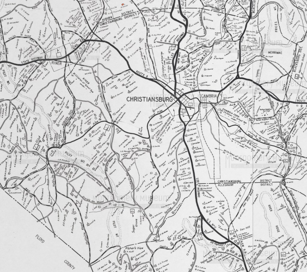
Christiansburg District
- Belmont (1 room)
- Christiansburg Institute
- Christiansburg Primary
- Christiansburg High School
- Ellett (4 rooms)
- Hill School
- Mosby (1 room)
- Sugar Grove (1 room)
- Weller Baker (Cambria, built 1935, still in use in 1969)
